 |
A unique approach to Civil War Mapping One Historical Map for Each and Every Day of the War |
|
| Home | Custom Maps | Interactive Maps | 2014 Calendar | Map Movie | Sample Maps | Contact Us | Help |
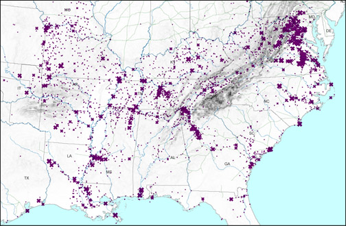
See Today in the Civil War150 Years Ago
Maps and Chronology
A special feature from civilwarhistorymaps.us |
 |
companion web site worldhistorymaps.com One map |
|
Help on viewing these Historical Maps of the World This help file was last updated March 17, 2012. Recommended Web Browser: All of the major browsers are now supporting SVG altho each one does it a little differently. We are in the process of upgrading all our maps to a common format which will work better with other browsers. However the upgrade is not yet complete. Therefore we are still recommending the Opera web browser for the best viewing of our maps. Opera has built in support for SVG and correctly displays the popup information. The latest version we have tested with is 11. Opera is available for free download at http://www.opera.com/download/. There is an Opera extension which does a much better job of zooming and panning. It works with Opera 11 and zooms in and out by using the mouse wheel. It is available for free at https://addons.opera.com/addons/extensions/details/svg-zoomnpan/1.1/?display=en Firefox web browser: The Mozilla
Firefox also has a built-in SVG and as of May 2011 (version 4.0)
Firefox now correctly displays the popup information. For more information
go to http://www.mozilla.org/projects/svg/faq.html#does.
Google Chrome web browser: The Google Chrome browser (version 11) will display the maps and does show the popup information. However it does not correctly display the ocean overlays as they are currently constructed. We are working to correct this problem. There also is no zoom and pan interface. Microsoft Internet Explorer: IE does now have built in SVG support but our maps are not set up in the proper format. Therefore you will still require a viewer plugin. The Adobe SVG viewer still works but support has been discontinued. Adobe SVG viewer discontinued: Adobe has discontinued support for its SVG viewer as of Jan 1, 2009. It still works for the time being and was the best solution for viewing our maps, however because the operating system environment keeps changing, using it could expose you to security or other problems. For more information go to http://www.adobe.com/svg/eol.htm. Popup Information: Information about the country that will appear in a popup window as the mouse hovers over a name. There may be a slight delay in appearing. General Information:
For each year there is an htm file and a corresponding svg file. The svg file opens within the htm file but you should be able to open the svg file by itself. The only reason that you would not be able to open the svg file directly would be that you have some other program defined as the default program to open svg files. Once you have displayed the map you can right click anywhere within the map boundaries and use the context menu to copy the svg image. Once you copy the svg image you can paste this into a picture editing program. SVG is a standard of the World Wide Web Consortium but each browser has defined its implementation differently. Note: These maps require significant system resources and may not work properly on older computers. Performance will also be slower when viewing the samples on the web. For fastest performance we suggest copying the contents of the CD to your hard drive. The maps display in layers and a slight delay may be experienced while layers are being drawn. |